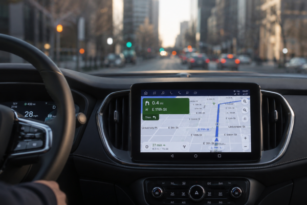
Navigation systems have come a long way from simple turn-by-turn directions displayed on a dashboard screen. Today, high-definition mapping technology is fundamentally reshaping how modern vehicles interpret and interact with their surrounding environment — setting a new benchmark for accuracy, safety, and intelligent mobility.
Unlike conventional GPS-based maps, which offer a broad and often imprecise overview of road networks, high-definition (HD) maps provide centimeter-level detail of roadways, including lane boundaries, road curvature, elevation changes, speed limits, traffic signs, and even surface conditions. This level of granularity is not simply an improvement — it represents an entirely different category of spatial data.
What Makes HD Mapping Different
Traditional navigation relies on general positioning data that can fluctuate by several meters depending on signal quality and environmental conditions. For everyday commuting, that margin may be acceptable. But as vehicles become more capable of autonomous or semi-autonomous operation, imprecision at that scale becomes a significant liability.
HD maps eliminate much of that uncertainty. Built through a combination of LiDAR scanning, high-resolution cameras, and sensor fusion technology, these maps capture the physical world with a depth and accuracy that conventional systems simply cannot match. The resulting data layers provide vehicles with a detailed pre-existing model of the road environment — one that onboard sensors can then validate and update in real time.
This fusion between pre-loaded HD map data and live sensor input allows a vehicle’s systems to anticipate road conditions before they are visually confirmed, giving advanced driver assistance systems (ADAS) and autonomous platforms a crucial advantage in decision-making speed and reliability.
The Role of HD Maps in Autonomous and Semi-Autonomous Driving
For vehicles equipped with advanced automation features — whether partial highway assistance or more sophisticated self-driving capabilities — HD mapping serves as a foundational pillar. These systems depend on knowing precisely where lane markings are located, where curves begin, and how the road behaves before the vehicle physically encounters those conditions.
In practice, this means a vehicle can begin adjusting its speed, steering angle, and lane position well in advance of a sharp bend or a merging lane — not because its cameras detected it in real time, but because the HD map already contained that information. The result is smoother, safer, and more predictable vehicle behavior in complex driving environments.
Beyond individual vehicle performance, HD maps also form an essential backbone for vehicle-to-infrastructure (V2I) communication, allowing connected platforms to cross-reference map data with live traffic management systems and roadwork alerts.
Keeping Maps Current: The Challenge of Dynamic Updating
One of the most demanding technical challenges associated with HD mapping is maintaining data freshness. Roads change — construction projects alter lane configurations, new signage is installed, and temporary restrictions appear with little notice. A static HD map, however detailed, becomes less reliable the moment the physical road diverges from what was recorded.
To address this, leading technology developers are investing heavily in cloud-connected map updating systems that rely on crowdsourced vehicle data. As equipped vehicles travel roadways, their sensors continuously detect and transmit anomalies between what they observe and what the existing map shows. These corrections are processed and redistributed to the broader fleet, creating a self-improving, living dataset that evolves alongside the real world.
The Road Ahead for Precision Navigation
High-definition mapping is no longer an experimental concept reserved for autonomous vehicle prototypes. It is increasingly embedded in production vehicles across multiple segments, quietly enhancing the performance of lane-keeping systems, adaptive cruise control, and predictive navigation features that drivers rely on daily.
As the automotive industry continues its transition toward greater vehicle intelligence and connectivity, HD mapping will likely become as foundational to modern mobility as the combustion engine once was to personal transportation — an invisible infrastructure that makes everything else possible.
The precision revolution on our roads is not coming. In many ways, it is already here.